Preserving the Green Legacy: The Story of Dorney's Land Ownership Developments
The land ownership developments in Dorney Parish from the mid-1800s to the 1930s were marked by several significant events and changes. Here is a summary of the key developments:
- 1846 Tithes: In 1846, there were 18 separate owners of land in Dorney Parish, indicating a fragmented ownership pattern.
- Concerns over town expansion: After the First World War, concerns arose among the Provost and Fellows of Eton College and Col. Charles Palmer regarding the potential absorption of Eton and Dorney into the rapidly growing town of Slough. They developed a plan known as the "Eton/Dorney Green Belt" to protect these areas from further encroachment.
- The Slough "Dump" at Cippenham Court Farm: In 1918, the government decided to compulsory purchase Cippenham Court Farm and five neighbouring farms (over 600 acres) to create a motor repair depot for government vehicles returning from overseas. This site, known as "The Dump," stored thousands of vehicles in various states of decay and disrepair. It raised concerns about the impact on the surrounding areas.
- Launch of Slough Trading Company Ltd: In April 1920, the Slough Trading Company Ltd was established after the government sold "The Dump" and its contents for over £7 million. The company's strategy was to sell off vehicles and lease land for factories. It attracted tenants such as Gillette Razor Company, Johnson & Johnson, Life Saver Sweets, and St. Helen's Cable and Rubber.
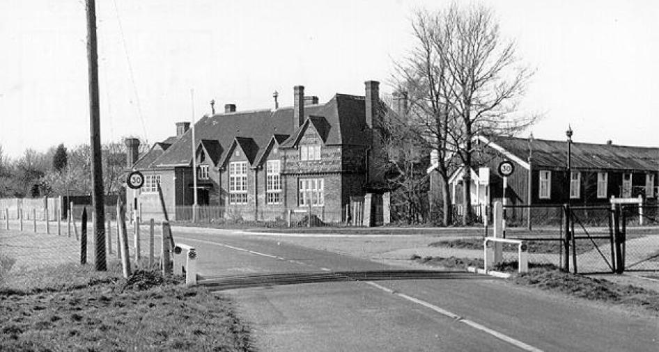
- Planned development of Manor Farm, Dorney Sewage Works: In 1902, Col. Charles Palmer agreed to lease 244 acres of Manor Farm, Dorney to Slough Urban District Council for use as a sewage farm. As the population of Slough increased, the council sought to purchase Manor Farm entirely to expand the sewage farm. After an inquiry, the land was compulsorily purchased.
- Eton College and Col. Charles Palmer's plan: In 1926, Eton College and Col. Charles Palmer devised a plan to protect the west side of Eton, Eton Wick, and Dorney from further land-purchasing incursions. They ensured that the majority of land surrounding these areas was owned by either Eton College or the Dorney Court Estate. By 1931, around 18 Dorney landowners had consolidated into two.
- Natural protection and boundaries: The River Thames and the M4 motorway, opened between 1956 and 1966, provided natural boundaries for the "Eton Green Belt" and further protected Dorney. The opening of the Jubilee River in 2002 added additional safeguards against encroachment.
The "Eton/Dorney Green Belt" created in the 1920s by Eton College and Col. Charles Palmer played a crucial role in protecting Dorney, Eton Wick, and Eton from further development and encroachment. Today, the land in and around Dorney is primarily owned by Eton College and the Dorney Court estate, with a commitment to preserving the green fields and maintaining the protection of these areas.
The implementation of the "Eton/Dorney Green Belt" in the 1920s was a forward-thinking initiative that aimed to safeguard the rural character and open spaces of Dorney, Eton Wick, and Eton from further urban expansion. This proactive approach by Eton College and Col. Charles Palmer ensured that the majority of the land surrounding these areas was either owned by Eton College or the Dorney Court estate.
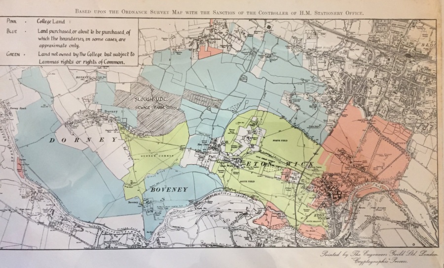
The map above, from around 1926, shows the extent of the plan, with pink representing land owned by Eton College, blue indicating land purchased or about to be purchased, and green representing land subject to Lammas rights or rights of Common. The black, hatched area represents the Manor Farm land, including the sewage works, which was eventually compulsorily purchased.
The natural boundaries of the River Thames and the newly constructed M4 motorway further fortified the protection of the "Eton/Dorney Green Belt."
Over the years, the "Eton/Dorney Green Belt" has played a vital role in preserving the rural and green character of Dorney. The ongoing commitment of Eton College and the Dorney Court estate to protect these areas against further incursions has been instrumental in maintaining the integrity of the landscape. Their ownership of the land surrounding Dorney, combined with the natural barriers provided by the Thames and the M4 motorway, has effectively safeguarded the area from excessive urban development.
In addition to the "Eton/Dorney Green Belt," the opening of the Jubilee River in 2002 further enhanced the protection of Dorney and Eton Wick from potential encroachment by the Slough Sewage Works.
The careful planning and vision displayed by Eton College and Col. Charles Palmer almost a century ago have left a lasting impact on the present state of Dorney. The preservation of the green fields and the ongoing commitment to protecting the area have contributed to the charm and beauty of Dorney as it exists today. The establishment of the "Eton/Dorney Green Belt" was a significant development in land ownership that continues to shape and safeguard the landscape for future generations. This foresight and proactive approach to land ownership helped maintain the distinct identity and separate landscape of Dorney, preserving its charm and protecting the parish from the potential adverse effects of urbanization.
Furthermore, the natural boundaries of the River Thames and the M4 motorway, combined with the land ownership pattern, reinforced the protection of the "Eton Green Belt." These physical features acted as additional safeguards, establishing clear boundaries between the developed urban areas and the rural green spaces of Dorney.