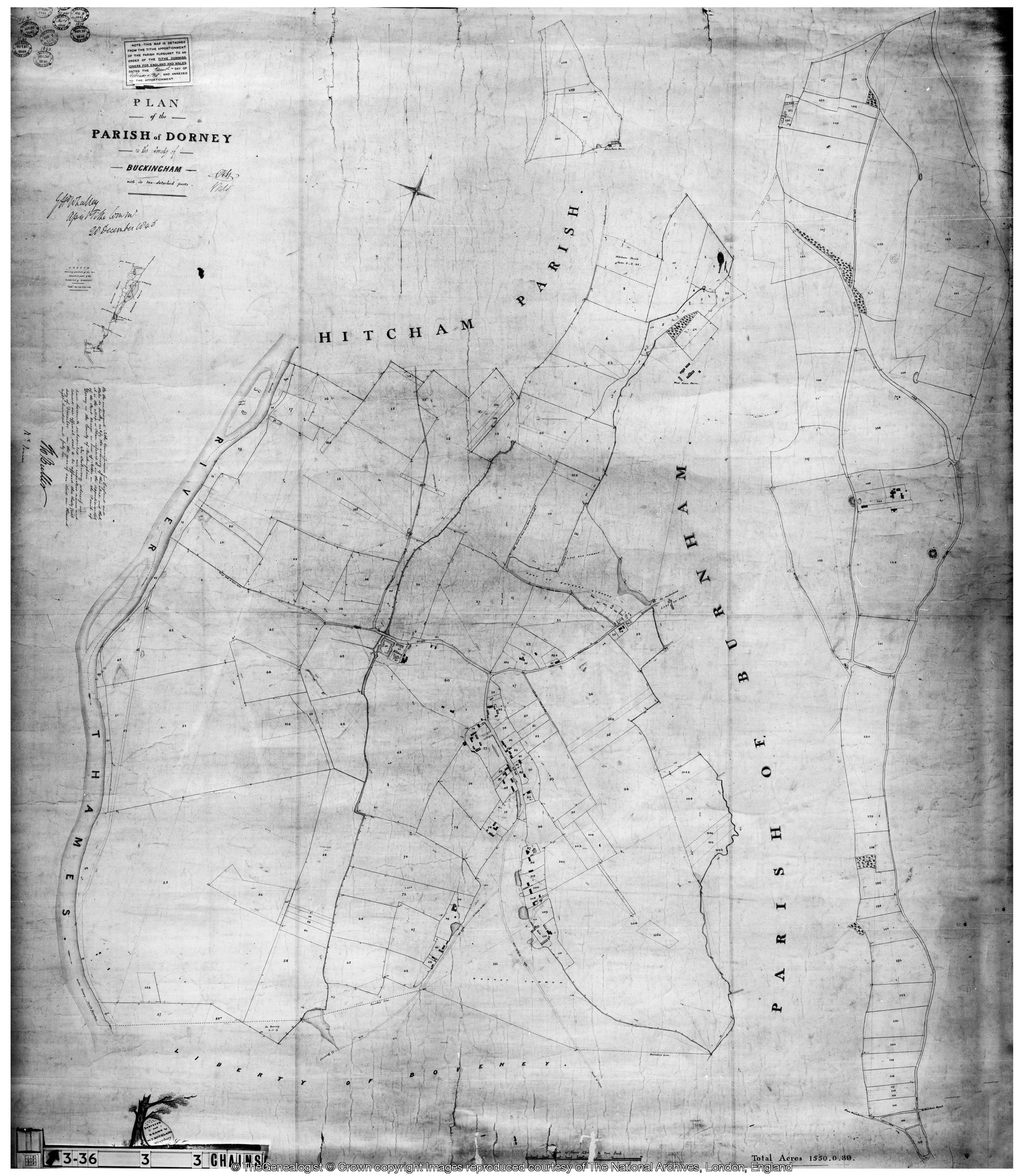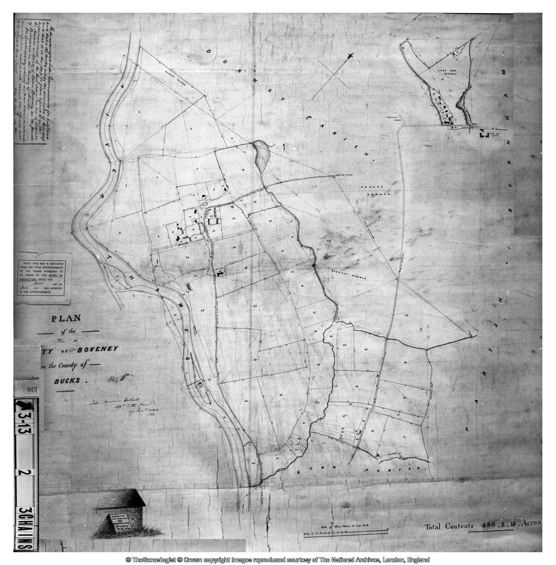
The 1844/6 Tithe Map & Apportionment Schedule of Dorney and Boveney [inc Lake End]
The Tithe Commutation Act 1836 was an Act of the Parliament of the United Kingdom. It replaced the ancient system of payment of tithes in kind with monetary payments. It is especially noted for the tithe maps which were needed for the valuation process required by the Act.
The Act substituted a variable monetary payment (referred to as the "corn rent") for any existing tithe in kind. This payment was originally calculated on the basis of seven-year average prices of wheat, barley, and oats, with each type of grain contributing an equal part to the total. Prices were determined nationally.
A commission was established to identify all affected properties and to resolve boundary issues arising from the survey.
A map was produced for each "tithe district", that is, an area in which tithes were paid as a unit. These were often distinct from parishes or townships. The maps indicated parcels of land and buildings, assigning each a number.
Associated with each map was an apportionment schedule, which listed each map item by number. For each entry the owner, tenant, area, name or description, state of cultivation, rent charge payable, and the tithe owner was listed.
The surveying was carried out between 1841 and 1851.
Dorney and Boveney's [including Lake End] Tithe Apportionment Schedule and Tithe Maps were completed between 1840 and 1846. They are below:
Dorney Boveney [inc. Lake End] Tithe Ap[...]
Adobe Acrobat document [506.6 KB]